
About
Press [M] at any time to bring up the world map.<br/> Drag the map to pan, scroll to zoom, and use the bookmark buttons to create and remove map markers.
Client-Side Features
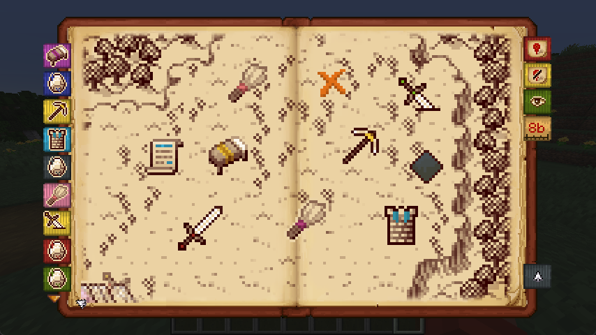
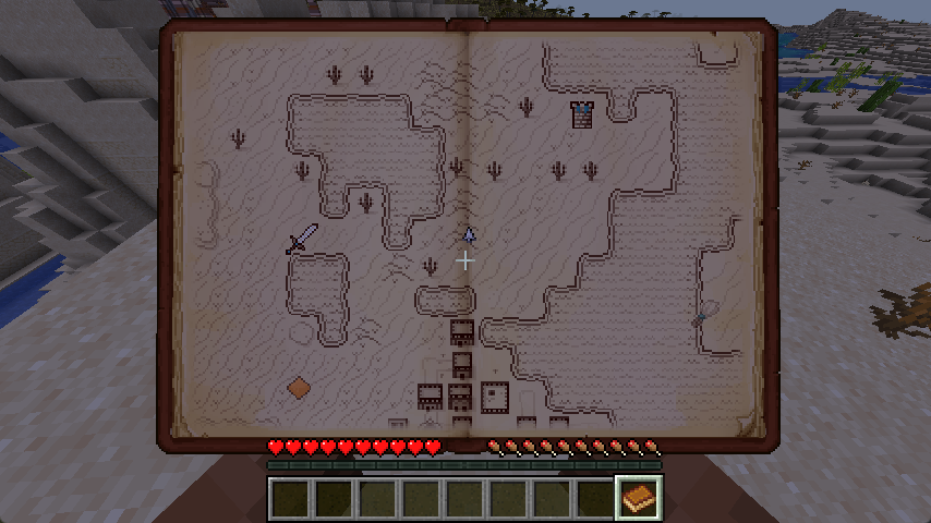
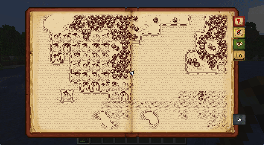
- A physical-feeling map screen, with hand-drawn tiles representing chunks in the world:

- Waypoint markers in a variety of styles and accent colors:
- Hold the map in your hands by renaming a book "Antique Atlas" at an anvil:
- Automatic migration of waypoints from Xaero's Minimap, and a shared save format with Hoofprint.
- Extra features via addons like Antique Trains and Dead Reckoning!
Mixed-Side / Singleplayer Features
- Markers are automatically added for notable structures and active nether portals:
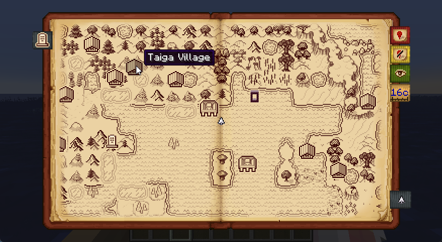
- Structures only appear on the map after you've looked at them or stood on them in-game:
- Map exploration and waypoints can be shared with friends via
/surveyor share [player]:

- Add AA4 Atlas to give the handheld atlas a full item ID and crafting recipe!
Troubleshooting / Suggestions
Antique Atlas 4 is a clientside map frontend for Surveyor Map Framework.<br/>
It renders surveyor save data as tiles on screen using respacks, and provides a GUI editor for waypoints.<br/>
Issues and suggestions regarding the screen, tiles, markers, and resource packs are Antique Atlas 4 Issues.<br/>
Issues and suggestions regarding map sharing, explored map area, and automatic markers are Surveyor Issues.<br/>
Crash reports must have AA4 and Surveyor on the latest version, and include logs/latest.log via mclo.gs.
Configuration
Antique Atlas can be configured from config/antique-atlas.toml or in-game using McQoy, including:<br/>
- Whether to require having an atlas item in the inventory in order to enable the map hotkey.
- Adjustments to the size and scale of the map screen.
- Adjustments to which structures to mark on the map.
- Adjustments for how to stylize player graves.
Additional options can be found in the Surveyor config in config/surveyor.toml.
Addon & Resource Pack Developers
Resource Packs
Tiles, markers, biome detection, and structure detection is fully data-driven via resource packs.<br/>
Without defined biomes, atlas "guesses" tiles via tags, and shows ??? if that fails.
For a how-to on AA4 resource packs, check out the resource pack tutorial.
API
Nothing stable! But feel free to poke around:
repositories {
	maven { url "https://repo.sleeping.town/" }
}
dependencies {
	modImplementation "folk.sisby:antique-atlas:3.0.0+1.20"
}
Try AtlasRenderer.registerOverlay() for non-surveyor mod compat (i.e. mods that already have client sync)
To automatically mark non-structure points of interest - instead use Surveyor's Landmark API.
Licensing + Credit
Please match your addon/respack licenses to LGPLv3 for code & CC BY-NC-SA for assets to help the ecosystem!<br/> (LGPLv3 and CC BY-NC-SA are a copyleft licenses, so this is required for anything directly adapted from AA4)
If you've made an addon/respack, hit us up and we might link it here! If it's still WIP feel free to ask us questions.<br/> Devs can reach out to us on mastodon, via email, or in #projects->Surveyor on ModFest.
Afterword
All mods are built on the work of many others.
The art for antique atlas was created by Hunternif (DA) and lumiscosity (Neocities).<br/> Click here for detailed art credit.
This mod is a loveletter rewrite, and relies heavily on contributions of many developers and artists before us.<br/>
Versions
**Changes:** - Fix crash when placing a custom marker without an associated stack - Add `PLAINS` setting for biome fallbacks that just uses a `minecraft:plains` provider. Changelog: https://github.com/sisby-folk/antique-atlas/releases/tag/v3.1.2+1.20
**Changes:** - Fix crash when placing a custom marker without an associated stack - Add `PLAINS` setting for biome fallbacks that just uses a `minecraft:plains` provider. Changelog: https://github.com/sisby-folk/antique-atlas/releases/tag/v3.1.2+1.20
**Fixes:** - Prevent editing global landmarks via GUI to avoid confusion Changelog: https://github.com/sisby-folk/antique-atlas/releases/tag/v3.1.0+1.20